

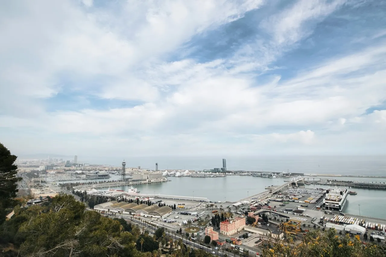
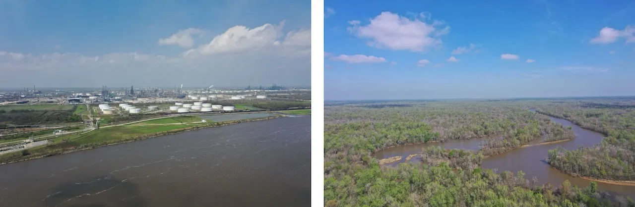
In the Beaumont–Port Arthur region, rich wetlands and bayous sit alongside one of the nation’s busiest energy corridors—where industry, biodiversity and environmental stressors converge. It's a place that demands both scientific insight and deep community knowledge to navigate complex trade-offs.
In this coastal part of Texas, environmental risk isn’t a distant threat—it’s a daily reality. Flooding, extreme heat, and poor air quality intersect in ways that disproportionately impact people who are historically overburdened by these risks. To better understand and address these compounding hazards, researchers from across Texas are partnering with local communities to find solutions.
At the center of this effort is the Southeast Texas Urban Integrated Field Laboratory (SETx-UIFL), one of only four Urban Integrated Field Labs in the nation. Led by The University of Texas at Austin and funded by the U.S. Department of Energy, the multi-year project brings together researchers from Planet Texas 2050 and Whole Communities Whole Health, Texas A&M, Prairie View A&M, Lamar University, Oak Ridge National Laboratory and Los Alamos National Laboratory. Unlike traditional research that studies communities from the outside, this project provides communities with scientific data while letting local priorities guide the research questions.
"There are lots of research projects that collect data and then leave,” said Paola Passalacqua, professor of water resources engineering at UT Austin and the project’s principal investigator. “This one is designed to build relationships and co-create knowledge that helps communities and decision-makers plan for a more resilient future."
Building the Infrastructure for Change
Now in its third year, the project has built sophisticated observational and modeling systems to monitor both air quality and flooding patterns. These systems are supported by a high-resolution dataset the team is producing specifically for Southeast Texas. Hydrological models and precipitation scenarios are used to simulate urban flooding, supported by a network of more than 200 ground-based water level sensors. On the air side, the team is studying both industrial pollution and other sources like marsh fires using mobile monitoring vans, canister sampling, and continuous sensors.
Recent findings have revealed significant gaps in how environmental risks are officially recorded and understood. In a recent paper published in AGU Advances, researchers found that remote sensing can detect five times more multi-hazard events—such as heat and flooding occurring together—than current estimates. The study also uncovered a blind spot in heat monitoring. The research revealed that chronic high temperatures in Gulf Coast communities are underrepresented in official heat indexes. By expanding the area classified as impacted by extreme heat by 50%, the team uncovered an additional $300 million in damages over the past 20 years, costs that had been invisible to policymakers and emergency managers.
"These findings suggest that much of what communities experience doesn’t get captured in official records," said postdoctoral researcher Matthew Preisser. "And if it’s not captured, it can’t be planned for or responded to."
Community-Centered Science
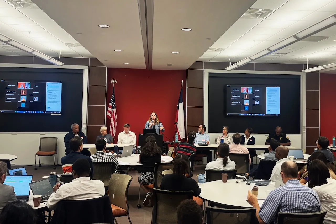
From the beginning, SETx-UIFL has prioritized community partnerships. Two task forces—one residential and one technical—meet quarterly to guide the research, share insights, and shape decisions like sensor placement. Built over three years, the task forces now include more than 19 members, representing residents, local governments, and industry.
"Our local partners told us, 'We've seen researchers come and go,'" said Passalacqua. "Our commitment is to be here, to listen, and to work alongside them."
"I want to see the natural resources of the area protected as well as the people—safe from pollution and flooding," said Ellen Buchanan, a longtime community partner who works with the Big Thicket Natural Heritage Trust and the Sierra Club.
The field lab's co-design model ensures that research leads to real-world action. Researchers created a "strategy catalog" of interventions like pump upgrades and water retention ponds, which are evaluated by community stakeholders for feasibility, cost, and relevance. Stakeholders then rank the options based on impact and barriers to implementation.
One of the most urgent strategies under consideration is emergency communication. "One of the biggest concerns about Beaumont and the surrounding region is that we lack effective ways to quickly get accurate information out to the community during natural disasters," said Jefferson County Constable Christopher Bates.
"Many people either aren’t aware of what's happening or rely on false information circulating on social media," he added. "There is also a general lack of awareness about local flood risks and air quality issues. If residents were better informed, they could take steps to protect themselves and be more prepared."
As a key community partner, Bates provided local data and insight to help address long-standing challenges in flood control and air quality. His firsthand knowledge helps ensure that community needs guide research priorities and shape practical solutions.
A Model That Works Across Scales
One of the scientific hurdles the team faces is modeling across multiple scales. Flooding and air pollution operate on different levels—from neighborhood drains to regional watersheds, and from block-level emissions to atmospheric dispersion across counties.
To bridge those scales, SETx-UIFL has developed computational models that link local and regional data, helping researchers and policymakers see how decisions in one area affect another. For example, a new flood barrier in one county might redirect water into another, while emissions in one area may lower air quality far downwind.
The project's Knowledge Management Platform integrates environmental datasets and produces 3D drone-based visualizations—such as digital twins of at-risk neighborhoods. These tools help local planners test strategies, assess risks, and conduct scenario-based planning.
Advancing Education and the Energy Economy
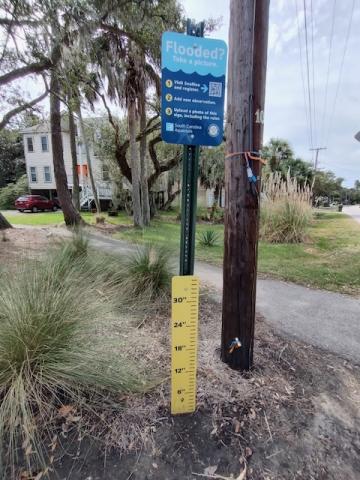
Beyond its scientific and community impacts, SETx-UIFL is also a training ground for future researchers. The recent three-day Summer Institute in Beaumont brought Ph.D. students and senior researchers together for hands-on fieldwork and interdisciplinary data analysis. The project’s research is also integrated into 10 courses across four Texas universities, connecting students directly with Southeast Texas challenges. The project has also pioneered low-tech community engagement tools.
The region's energy economy adds urgency to the work. While air quality findings related to industrial emissions are still being finalized, industry participation in task force discussions signals growing interest in collaboration.
"These companies understand that communities don't always trust their data,” said Passalacqua. "Our external measurements can serve as a check, a validation, or a challenge. Either way, it's better data and better transparency for industry."
Lasting Impact
As SETx-UIFL enters its final phase, the team is focused on making their findings accessible and actionable. New dashboards and visual tools are being co-developed with community input, and policy engagement is increasing at the local level. With more than 50 conference presentations and peer-reviewed publications already, the project is influencing not just Southeast Texas, but the national conversation on community-centered climate science.
"Ultimately, we're trying to demonstrate what research can look like when it’s done with—not just about—communities," said Passalacqua. "That’s how you build resilience and trust."