

Researchers at the University of Texas at Austin are working with state and local agencies to create a mobile application that will improve the way emergency departments respond to flooding.
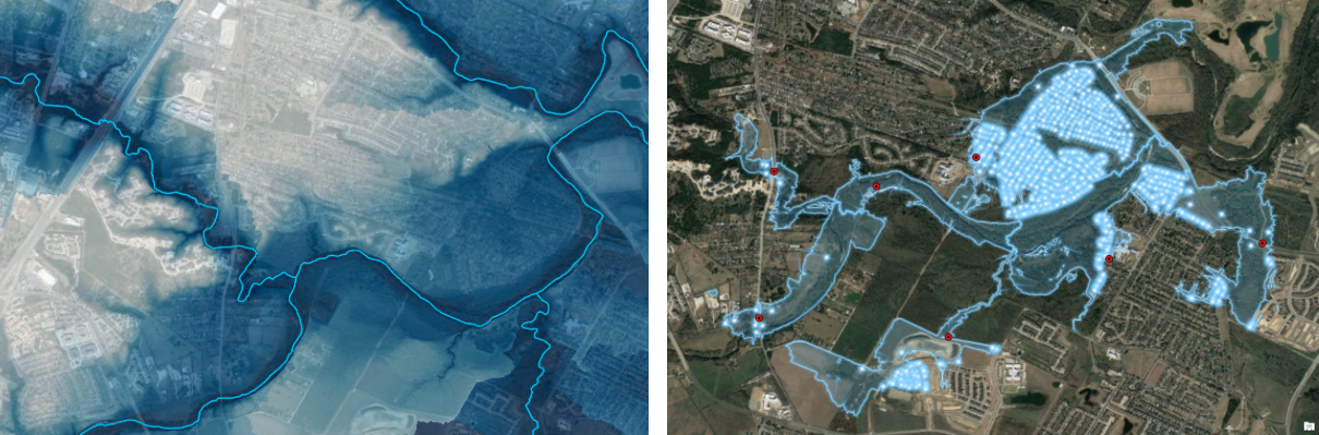
The web-based app, called Pin2Flood, will allow first responders to track — and potentially in the future predict — flooded areas in real time. When firefighters arrive at a scene, they will be able to drop a digital “pin” in places where they see flooding. The app will then return an accurate flood map in minutes, showing other areas that are at risk. This will help emergency departments make life-saving decisions, such as where to order evacuations or send critical resources.
“When you’re a firefighter responding to a flood at 2 a.m., and you see water in a neighborhood, it’s hard to tell the extent of the flood and how bad it is,” says Harry Evans, former Austin Fire Department Chief of Staff who has been advising on the project. “You’re not sure whether you have seven homes or 700 that need help or whether to send a dozen firefighters or a team of rescue boats. The answers to those questions are important. With this app, the first responder can get an immediate map of the flood in front of them so they know the scope and magnitude of the problem.”
Underpinning the app are sophisticated flood maps for the entire state of Texas that UT researchers from the Cockrell School of Engineering and the Center for Water and the Environment have spent years designing. Using the supercomputing power of the Texas Advanced Computing Center, they incorporate a trove of data, including LiDAR images that reveal the state’s topography, river basin depth and drainage, current precipitation rates and detailed maps of all the structures in Texas — so that fire departments know whether a flood is inundating homes or just an empty field.
The Federal Emergency Management Agency and Planet Texas 2050-funded app is expected to be completed in 2023 and rolled out to emergency departments across the state through the Texas Division of Emergency Management.
Learn more about the science behind the app from reporter Mose Buchele at KUT.