

When disasters strike, from hurricanes to disease outbreaks, communities need more than just forecasts — they need the full picture. Planet Texas 2050 researchers are building powerful new tools that use artificial intelligence to combine sensor data, scientific models, and even personal stories from people on the ground.
By blending storm surge projections, flood patterns and public health risks with local knowledge, the AIM (AI-enabled Model Integration) Flagship project is transforming raw data into real-time, life-saving insights during natural disasters and their aftermath - redefining what it means to prepare for a more resilient Texas.
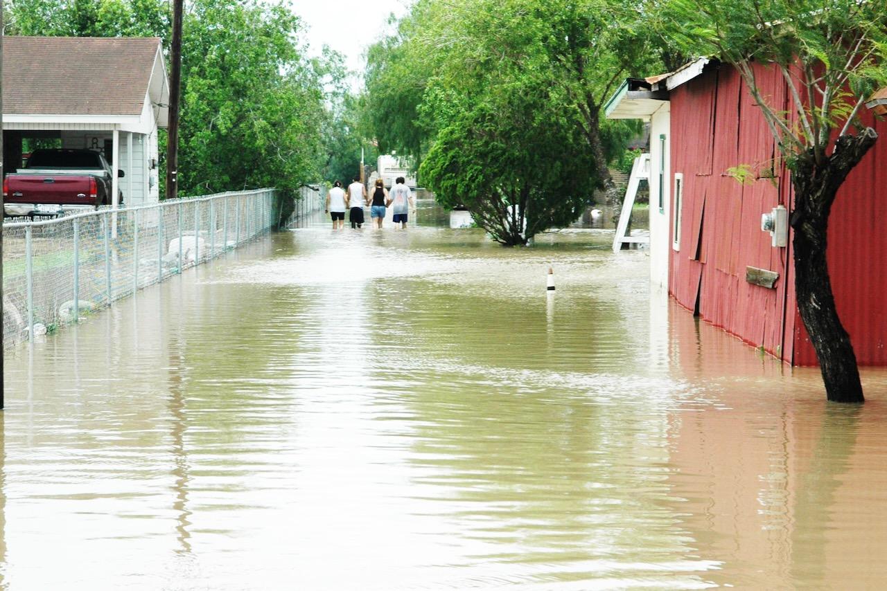
The AIM project is a comprehensive, interdisciplinary initiative involving collaboration between University of Texas researchers and partners at UT Rio Grande Valley and the Museum of South Texas History (MOSTHistory), a regional community hub. The team is leveraging AI to build knowledge driven decision support tools to better inform and protect people from weather-induced flood hazards in South Texas where nearly 20% of the state’s population lives in highly vulnerable low-lying coastal counties.
To date, the project has led to significant advancements in AI-enabled model integration, the ways that artificial intelligence connects the dots between different kinds of data sources and information. The research team uses computational narrative and semantic AI approaches to combine information from computer models with narratives, photos and community discussions so that advanced decision support tools and communications guidelines can be created for weather-related disasters and the increased risk of infectious disease that follows as flood waters recede.
Not Just About Data – It’s About People
The AIM project is filling gaps in existing knowledge and creating user-oriented tools to make complex decision-making more accessible and replicable in Texas and beyond.
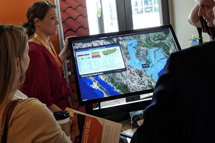
At the helm is research scientist Suzanne Pierce, a long-time leader in transdisciplinary research, intelligent systems and decision sciences. "AIM has morphed over time in the way it gets implemented," she says, "but not in terms of the vision. The vision has been consistent for the data and knowledge infrastructure we're creating for convergent research and to combine scientific data with residents' lived experiences."
The AIM Flagship includes multiple sub-projects targeting different hazard-related challenges, leveraging expertise and capabilities at the Texas Advanced Computing Center and the Oden Institute for Computational Engineering and Sciences. At its centerpiece is a powerful yet flexible digital ecosystem.
How the Tools Work
- The research cyberinfrastructure is anchored by the DataX Portal, the core service for managing data and accessing advanced computing resources.
- Model INTegration supports containerized physics-based models for simulations of various processes.
- Enhanced by components that capture and collect information:
- uP-STREAM (machine-readable sensor, satellite or image data)
- Sites and Stories (unstructured data that is often non-machine-readable like videos, field notes and interviews)
- Cookbook Services (reproducible analytical notebooks)
- DOLCE (data preservation) makes data discoverable and allows for preservation and curation of data in the Texas Data Repository, managed by UT Libraries, ensuring long-term accessibility and usability.
Spreading the Message
AIM doesn't stop with the supercomputers — a key part of the project is finding ways to actively increase awareness and vigilance among communities by designing public engagement experiences across Texas and beyond.
UT's Clint Dawson, professor and department chair in aerospace engineering and engineering mechanics, and historian Francisco Guajardo, MOSTHistory CEO developed ways to discuss the importance of hurricane forecasting and modeling with the public as part of the museum’s speaker series. One of their efforts included gathering historical data and personal stories from residents to model Hurricane Beulah, a major hurricane that hit the Rio Grande Valley in 1967.
The team recreated the hurricane's impact using augmented reality, scientific modeling, and incorporating the first-person narratives. With the help of Pierce, they also created "story-informed collections" which blend photographs, personal accounts, and data visualizations into interactive museum exhibits and sandbox simulations.
"People's stories add humanity, context and relevance to the scientific modeling," said Guajardo.
"If you can connect the historical insight from people with simulations and predictive tools," Pierce explains, "you can change the way people understand the world—and ultimately, how they act."
These accessible approaches — combining computational narrative analysis with participatory decision modeling — have also been shaped by research experiences in Alaska. AIM's tools have been tested in remote Arctic communities through National Science Foundation funding and then adapted for use back in Texas. The result: scalable, reusable information that’s meaningful to different stakeholders facing different environmental challenges.
Helping the People Who Want to Help
More frequent and severe flooding coupled with Texas' rising temperatures creates suitable environments for neglected tropical diseases (NTDs), a diverse group of infections, including parasitic, viral, bacterial and fungal diseases. NTDs have not received adequate attention by public health officials or the public and there are no existing open-sourced tools to track and diagnose them.
To help address this gap, senior research fellow Katherine Brown develops translational medical tools and predictive models to diagnose and track infectious diseases, focusing on environmental changes driven by weather and climate patterns affect the spread of pathogens.
The connections made by AIM are not just theoretical. In one case, an interactive map of infectious disease vulnerability—created by Brown and colleague Michael Shensky—was discovered via a Google search by a physician treating a pediatric patient with mysterious symptoms that appeared after a flood. That map led to the correct diagnosis and treatment, supporting the medical team that saved the child’s life. "Better access to data collections that relate to real world problems is the kind of impact we're striving for," Pierce says.
"Our work addresses friction points in the decision-making process," Pierce says. "Whether that's getting sensor data into our systems or capturing non-machine-readable lived experiences, we've built services to make data fusion easier."
Recent milestones include collaboration with the Texas Water Development Board on the state’s coastal communication guidelines, Department of Engineering funding to deploy air quality monitoring in Southeast Texas, and a plan to create a digital twin of downtown Edinburg, Texas using drone data to aid citizen planning to protect themselves and their businesses from heavy rainfall and flash floods.
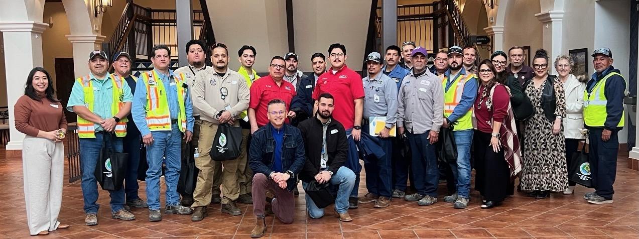
This summer, the team presented these results at MOSTHistory, where AIM has hosted seasonal exhibits and participated in the Sunday speaker series for four years running. And looking forward, the team hopes to continue expanding and applying AIM's concepts to regions across Texas and the nation.